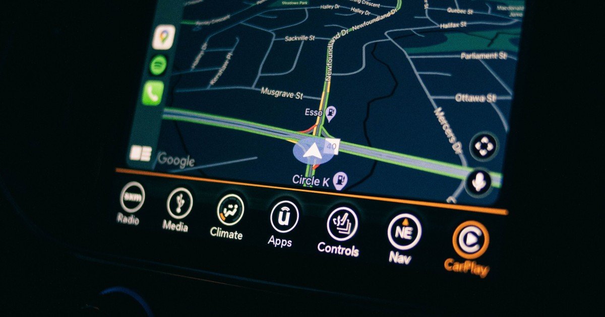
You can open a map, tap the location button, and watch a blue dot appear almost instantly, but how does GPS determine your exact location when there is no visible landmark telling your phone where you are? GPS works by measuring the travel time of signals transmitted by satellites orbiting Earth. A GPS receiver uses signals from multiple satellites to calculate how far away each one is, then combines those distance measurements to estimate its position on Earth. Your phone may also combine satellite positioning with cellular networks, Wi-Fi, sensors, and other technologies to make the location result faster and more reliable.
The fascinating part is that GPS does not work by having satellites directly “look down” and identify your phone. The satellites continuously broadcast precisely timed signals. Your device listens to them and performs the calculations needed to determine where it is.
That simple idea depends on incredibly accurate timing, orbital information, mathematics, radio signals, and corrections for effects that can slightly alter the journey of the signal.
Once you understand the process, the blue dot on your phone stops looking like magic and starts looking like what it really is: the result of a sophisticated positioning system operating quietly in the background.
What Is GPS and What Does It Actually Do?
GPS stands for Global Positioning System.
It is a satellite-based positioning system that allows compatible receivers to estimate their position, velocity, and time.
GPS was developed as a global navigation system, but its uses have expanded far beyond traditional navigation.
Today, positioning technology helps support:
- Smartphone navigation
- Vehicle navigation systems
- Aviation
- Maritime navigation
- Surveying
- Mapping
- Emergency location services
- Fitness tracking
- Agriculture
- Logistics
- Timing for communication systems
- Scientific research
- Location-aware applications
One important clarification is that GPS is specifically the satellite navigation system operated by the United States.
It is part of a larger family of global navigation satellite systems, commonly called GNSS.
Other systems include Galileo, operated by the European Union, GLONASS from Russia, and BeiDou from China.
Modern smartphones often support multiple satellite systems rather than relying exclusively on GPS satellites.
This can give the receiver access to more signals and potentially improve availability and positioning performance.
How Does GPS Determine Your Location?
At its core, GPS determines location by measuring distances between the receiver and multiple satellites.
A satellite continuously broadcasts a radio signal containing information about:
- The time the signal was transmitted
- The satellite’s orbital information
- Information needed by the receiver to understand the satellite’s position
Your device receives the signal and compares the transmitted timing information with the time the signal arrived.
Because radio signals travel at approximately the speed of light, the difference between transmission time and reception time can be used to estimate the signal’s travel distance.
With signals from multiple satellites, the receiver can calculate its position.
The basic sequence is:
Satellite transmits signal → receiver detects signal → receiver estimates travel time → travel time becomes distance → multiple distances are combined → receiver calculates position
This process is known as trilateration, although the full technical picture is more sophisticated because the receiver also has to account for clock differences and other sources of error.
Why Does GPS Need Multiple Satellites?
One satellite is not enough to determine your complete three-dimensional position.
Imagine standing somewhere on Earth and knowing that you are exactly 20,000 kilometers from one satellite.
You could be anywhere on a huge spherical surface surrounding that satellite.
Now imagine receiving information from a second satellite.
The possible positions become much more restricted because your location must satisfy both distance measurements.
Add a third satellite, and the possible position becomes more constrained still.
In practical GPS positioning, a receiver generally needs signals from at least four satellites to solve for three-dimensional position while also accounting for the receiver’s clock error.
This is one of the most important ideas behind GPS.
Why Four Satellites Instead of Three?
A position in three dimensions involves three unknown coordinates.
You can think of them as:
- Latitude-related position
- Longitude-related position
- Height
But there is another unknown: the receiver’s clock offset.
The clocks carried by satellites are extraordinarily precise. A typical consumer receiver, however, does not contain an atomic clock comparable to the clocks used in the satellite system.
So the receiver must solve for both its location and its clock error.
That is why an additional satellite measurement is needed.
With enough usable signals, the receiver can solve a set of equations that estimates its position and the timing offset.
What Is Trilateration in GPS?
Trilateration is often confused with triangulation.
They are not the same thing.
Triangulation determines position primarily from angles.
Trilateration determines position using distances.
GPS relies primarily on distance measurements derived from signal timing.
Imagine drawing an imaginary sphere around each satellite.
The radius of each sphere represents the estimated distance from the satellite to your receiver.
Your location should be near the point where these spheres intersect.
In a perfect mathematical world, the measurements would line up exactly.
Real-world signals are affected by several sources of error, so the receiver performs calculations that find the position that best fits the available measurements.
This is why GPS is better understood as a continuous estimation problem rather than a simple geometric intersection.
How Do GPS Satellites Know Their Own Location?
A GPS receiver needs to know where the satellites were when they transmitted their signals.
That information comes from orbital data included in the satellite navigation message.
GPS satellites follow carefully monitored orbits.
Ground control infrastructure tracks the satellites and maintains information about their orbital states and clock behavior.
The satellites then broadcast updated navigation information to receivers.
The receiver uses this information to determine where each satellite should be at the relevant transmission time.
This is critical.
Knowing that a signal came from “Satellite A” is not enough.
The receiver needs to know where Satellite A was when the signal was transmitted.
Only then can the distance measurement be used effectively in the positioning calculation.
Why Are Atomic Clocks Important to GPS?
The GPS system depends heavily on accurate time.
This is one of the most interesting aspects of satellite navigation.
GPS positioning is fundamentally a timing problem.
If a signal travels at roughly the speed of light, even a tiny timing error can translate into a substantial distance error.
That is why GPS satellites carry extremely precise clocks.
These clocks provide the timing reference needed for the system to work.
Your phone does not need to contain an atomic clock because the receiver can estimate its own clock offset using signals from multiple satellites.
This is a clever part of the system.
Instead of requiring every phone, car, or smartwatch to carry an extraordinarily precise clock, the positioning calculation treats the receiver’s clock error as another unknown.
The result is a practical system that allows relatively inexpensive devices to determine their location using extremely precise satellite timing.
What Happens When a GPS Signal Reaches Your Phone?
Your phone contains a GNSS receiver capable of detecting signals from compatible navigation satellites.
The receiver’s antenna picks up very weak radio signals arriving from satellites overhead.
The receiver then processes those signals.
It must identify usable satellites, determine the relevant signal timing information, decode navigation data, estimate signal travel times, and perform positioning calculations.
This can happen surprisingly quickly.
Modern smartphones may also use information from previous positioning sessions to make the process faster.
For example, a phone may already have an approximate idea of where it is, which satellites are likely to be visible, and what orbital information is relevant.
This can reduce the time required to establish a useful position.
Why GPS Does Not Always Give the Same Accuracy
You may notice that your phone’s location is sometimes remarkably precise and other times slightly wrong.
This is normal.
GPS accuracy depends on the quality and geometry of the available signals and the surrounding environment.
Factors that can affect positioning include:
- Buildings
- Mountains
- Trees
- Atmospheric conditions
- Satellite geometry
- Signal reflections
- Receiver quality
- Antenna design
- Interference
- Obstructions
- Availability of correction information
An open field provides very different conditions from a dense city center.
In an open area, a receiver may have a clear view of many satellites.
In a city, signals can reflect from buildings before reaching the phone.
These reflected signals can cause the receiver to measure a path that is longer or otherwise different from the direct satellite-to-device path.
This phenomenon is called multipath.
What Is GPS Multipath Error?
Multipath occurs when a signal reaches a receiver through multiple paths.
One signal may arrive directly from a satellite while another has reflected off a building.
The receiver can then encounter several versions of the same signal.
This can complicate timing measurements.
Urban environments are particularly challenging because tall buildings can create what is sometimes described as an urban canyon.
A phone standing between tall buildings may have limited visibility of the sky and may receive reflected signals from surrounding structures.
This can cause the location estimate to shift.
That explains an everyday experience many people recognize: the blue location dot may appear to jump from one side of a street to another while walking through a dense city.
The problem is not necessarily that GPS suddenly stopped working.
The receiver is trying to estimate position from imperfect signals in a difficult environment.
How Does Your Phone Improve GPS Accuracy?
Your smartphone usually does not rely on satellite signals alone.
Modern location services can combine information from several sources.
These may include:
- GNSS satellite signals
- Wi-Fi positioning
- Cellular network information
- Bluetooth-related information
- Accelerometers
- Gyroscopes
- Magnetometers
- Barometers
- Device movement data
This is one reason the location shown by a modern smartphone can become available very quickly.
GPS and Wi-Fi Positioning
If your phone can detect nearby Wi-Fi networks whose approximate locations are already known, that information can help estimate where you are.
This can be particularly useful indoors, where satellite signals may be weak or unavailable.
GPS and Cellular Positioning
Cellular networks can also provide location clues.
A phone can estimate its position based on nearby cellular infrastructure and signal characteristics.
Cellular positioning is generally less precise than high-quality satellite positioning, but it can provide useful information when satellite signals are limited.
GPS and Motion Sensors
Your phone’s accelerometer and gyroscope can help track movement between positioning updates.
For example, if your phone knows that you were moving in a particular direction and then temporarily loses a strong satellite signal, sensor information can help maintain a reasonable estimate for a short period.
Combining multiple information sources is often called sensor fusion.
What Is Assisted GPS?
You may have heard the term A-GPS, or Assisted GPS.
Assisted GPS uses network connectivity to help a device obtain information that can make satellite positioning faster or more efficient.
A conventional satellite receiver may need to acquire navigation information directly from satellite signals.
A connected smartphone can obtain supporting information through a network connection.
This can reduce the time required to begin calculating a useful location.
The key point is that assisted positioning does not mean your phone is replacing satellites with the internet.
Instead, network assistance can help the receiver make better use of satellite positioning.
Modern smartphones use broader GNSS and location technologies, so the practical architecture can be more sophisticated than the name A-GPS suggests.
What Is GPS Accuracy in Real Life?
People often ask how accurate GPS actually is.
There is no single answer that applies to every situation.
Under favorable conditions, consumer devices can often determine their position within a relatively small area.
But real-world accuracy can become worse in difficult environments.
An open outdoor area can produce a very different result from a room inside a large building.
Accuracy also depends on whether the device is using only standalone satellite positioning or additional correction and sensor information.
Professional surveying equipment can achieve dramatically higher accuracy than a typical smartphone by using advanced receivers, correction services, specialized antennas, and sophisticated processing techniques.
So when someone says “GPS is accurate to a few meters,” that should not be interpreted as a universal guarantee for every device and every location.
Why Does GPS Work Better Outdoors?
GPS satellites orbit far above Earth, so the receiver generally needs a reasonably open view of the sky.
Outdoors, a phone can potentially receive signals from many satellites at different angles.
Inside buildings, signals may be weakened or blocked by roofs, walls, metal structures, and other materials.
Some modern devices can still estimate location indoors using Wi-Fi, cellular signals, Bluetooth, sensors, and other technologies.
But satellite positioning itself generally works best when the receiver has good access to the sky.
This is why a phone may take longer to establish a precise location immediately after you enter a large building.
What Are GPS Errors Caused by the Atmosphere?
GPS signals do not travel through empty space from the satellite to your phone.
They pass through Earth’s atmosphere.
Different layers of the atmosphere can affect radio signals in ways that alter their propagation speed and timing.
The ionosphere is particularly important because it can affect satellite navigation signals.
The troposphere, the lowest major layer of Earth’s atmosphere, can also influence signal propagation.
GPS systems use models and additional techniques to account for these effects.
Some advanced positioning systems can use multiple frequencies and correction information to reduce atmospheric errors more effectively.
This is another reason professional positioning equipment can achieve accuracy far beyond ordinary consumer navigation.
What Is Differential GPS?
Differential GPS uses correction information from a reference station at a known location.
The reference station observes GPS errors affecting its own measurements.
Because the station knows where it is, it can estimate certain errors and provide correction information to another receiver.
This can significantly improve positioning accuracy under suitable conditions.
More advanced techniques, including real-time kinematic positioning and precise positioning methods, can achieve very high accuracy when the necessary infrastructure, correction data, satellite observations, and equipment are available.
These approaches are important in surveying, construction, agriculture, mapping, and other applications where ordinary consumer GPS accuracy is not sufficient.
Does GPS Work Without Mobile Data?
Yes.
A GPS or GNSS receiver can determine position using satellite signals without needing cellular internet access.
However, the overall location experience on a smartphone can benefit from network connectivity.
Mobile data can help provide assistance information, map data, Wi-Fi positioning information, traffic information, and other services.
This distinction is important.
Satellite positioning and internet connectivity are separate technologies.
You can have GPS positioning without mobile internet.
But some smartphone navigation features may not work fully without a network connection because the application needs online map data or other services.
How Does GPS Know Your Height?
GPS can estimate three-dimensional position, including altitude.
However, vertical accuracy is generally more challenging than horizontal positioning.
The geometry of visible satellites matters, as does atmospheric behavior, receiver quality, signal reflections, and other factors.
There is also an important distinction between different definitions of height.
Satellite positioning calculations relate naturally to an ellipsoidal mathematical model of Earth, while maps and everyday applications often use heights related to mean sea level or a geoid model.
Software can apply geodetic models to translate between these concepts.
This is why altitude readings on phones and fitness watches can sometimes appear surprisingly different from the elevation you expect from a map.
Why Does the GPS Blue Dot Sometimes Jump?
If you have ever watched your location dot move unexpectedly, you have seen the effects of imperfect positioning.
The phone is constantly updating its estimate.
If a new group of satellite signals becomes available, or if the signal environment changes, the calculated position can shift.
Buildings, trees, tunnels, reflections, atmospheric conditions, and sensor information can all influence the estimate.
Navigation applications often smooth location data to make movement appear more natural.
The application may also use road information and movement patterns to determine the most likely route.
This means the position shown on a map is not always a raw satellite measurement.
It may be the result of several technologies working together.
GPS vs GNSS: What Is the Difference?
GPS is one satellite navigation system.
GNSS is the broader term for satellite navigation systems as a category.
A modern receiver may use signals from several constellations.
This can provide access to more satellites and improve availability in challenging environments.
For example, if buildings block part of the sky, having access to multiple satellite constellations can increase the number of usable signals.
However, more satellites do not automatically guarantee perfect accuracy.
Signal quality, geometry, interference, atmospheric conditions, multipath, and receiver design still matter.
The important takeaway is that many modern devices are better described as GNSS-enabled rather than simply GPS-only.
How GPS Is Used Beyond Navigation
GPS technology has become deeply embedded in modern infrastructure.
Navigation is only one application.
Location and precise timing information can support:
- Fleet management
- Agriculture
- Mapping
- Emergency response
- Aviation
- Maritime operations
- Scientific research
- Construction
- Surveying
- Telecommunications timing
- Financial infrastructure timing
- Logistics
- Fitness tracking
The timing capability is especially interesting.
GPS satellites provide highly accurate time references that can be used by systems far beyond traditional navigation.
In other words, satellite navigation technology is also an important timing technology.
GPS and Modern Smartphones
Smartphones have transformed GPS from a specialized navigation technology into an everyday utility.
Your phone can use location information for maps, weather applications, photography, ride services, fitness applications, emergency features, local search, and many other functions.
But the phone’s location system is not simply a tiny GPS device.
It is a combination of satellite receivers, communication networks, sensors, software, digital maps, and algorithms.
That combination is why modern location services can feel much smarter than traditional standalone GPS receivers.
A smartphone can use context to interpret positioning information.
For example, it can understand that you are walking, driving, or remaining stationary based on sensor information.
This creates a much richer location experience than simply displaying latitude and longitude.
GPS and Privacy: What Should Users Know?
Location data can be extremely sensitive because it can reveal patterns about where a device has been.
GPS itself does not automatically send your location to a company.
The satellite system primarily broadcasts signals toward Earth, and your receiver uses them to calculate its position.
What happens afterward depends on the device and applications you use.
An application may request permission to access your location.
If granted, the application may use that information for navigation, recommendations, analytics, safety features, or other purposes depending on its design and privacy practices.
For users, the practical lesson is simple: understand which applications have location permission and review privacy settings regularly.
Location technology can be extremely useful, but it is worth treating location information as valuable personal data.
The Future of GPS and Location Technology
Satellite positioning continues to evolve.
Modern navigation systems are becoming more capable of using multiple constellations, multiple frequencies, improved correction techniques, better antennas, and sophisticated sensor fusion.
At the same time, smartphones are becoming increasingly capable of combining satellite signals with local environmental information.
This means future location systems will increasingly be about positioning intelligence, not just satellite reception.
A device may combine satellite signals, inertial sensors, visual information, Wi-Fi observations, cellular information, and digital maps to estimate where it is and how it is moving.
This broader development also connects with intelligent software.
As devices become better at understanding location and context, software systems can use that information to perform more useful tasks automatically. Readers interested in how modern AI systems can move beyond simple responses and perform multi-step actions can explore What Is Agentic AI? How AI Agents Work and What They Can Do.
For a related look at the difference between conversational systems and action-oriented AI, see AI Agents vs Chatbots: What Is the Difference and Which Is Better?.
Frequently Asked Questions
How does GPS determine your exact location?
GPS determines location by measuring the travel time of signals from multiple satellites. The receiver uses those measurements, satellite orbital information, and timing data to calculate its position.
How many satellites does GPS need to find your location?
A receiver generally needs signals from at least four satellites to solve for three-dimensional position while also estimating its own clock error. More usable satellites can improve availability and positioning geometry.
Does GPS use the internet to find your location?
No. GPS positioning itself can work from satellite signals without internet access. However, smartphones can use cellular or internet connectivity to speed up positioning and provide additional location information.
How accurate is GPS on a smartphone?
Accuracy varies with the device and environment. Open outdoor conditions can provide better results than dense urban areas, indoors, or locations where signals are obstructed or reflected.
Why does GPS sometimes show the wrong location?
GPS errors can result from buildings, signal reflections, atmospheric effects, poor satellite geometry, interference, weak signals, and limitations of the receiver. Smartphones may also combine GPS with other positioning technologies.
What is the difference between GPS and GNSS?
GPS is the United States satellite navigation system. GNSS is the general term for global satellite navigation systems, including GPS and other systems such as Galileo, GLONASS, and BeiDou.
Does GPS work indoors?
Satellite positioning can be difficult indoors because buildings can weaken or block signals. Smartphones may still estimate indoor location using Wi-Fi, cellular signals, Bluetooth, sensors, and other technologies.
Why does GPS need an atomic clock?
GPS relies on extremely precise timing because the receiver estimates distance from the travel time of radio signals. Tiny timing errors can create significant distance errors. Satellite atomic clocks provide the highly accurate timing reference needed by the system.
Can GPS determine altitude?
Yes. GPS and other GNSS systems can estimate three-dimensional position, including height. However, vertical accuracy is typically more challenging than horizontal positioning, and the reported altitude depends on the reference model being used.
Is GPS the same as location services on a phone?
No. Smartphone location services can combine GPS or other GNSS signals with Wi-Fi, cellular information, Bluetooth, motion sensors, maps, and other data sources to produce a location estimate.
How GPS Determines Your Exact Location
So, how does GPS determine your exact location?
It starts with satellites broadcasting precisely timed radio signals from known positions in space. Your receiver listens for those signals and measures how long they took to arrive. With measurements from multiple satellites, the receiver calculates the distances involved and solves for its position while also accounting for its own clock offset.
But modern location technology goes beyond basic satellite positioning.
Your smartphone may combine GNSS signals with Wi-Fi, cellular networks, motion sensors, digital maps, and other information. Corrections and sophisticated processing can further improve accuracy.
The result is the location experience we now take for granted: a blue dot showing where you are, turn-by-turn navigation guiding you through unfamiliar streets, fitness apps recording your route, and countless other services responding to your physical position.
What looks like a simple point on a map is actually the product of precise clocks, satellites, radio signals, mathematics, orbital models, sensors, and software working together.
GPS does not know where you are because a satellite is watching you. It knows because your receiver can measure carefully timed signals and calculate the position that best fits those measurements.
That is the real ingenuity behind GPS: your location is not directly observed; it is calculated from time, distance, geometry, and increasingly sophisticated supporting information.
Informational Disclaimer: This article is intended for general educational purposes only. GPS and GNSS accuracy can vary according to receiver hardware, satellite availability, atmospheric conditions, signal obstructions, correction services, software, and local environmental factors. Specific positioning performance should not be assumed for safety-critical applications without appropriate professional systems.






Leave a Reply